
Browse Items (61 total)
- Collection: Rural Scenes of Turner County
Sort by:
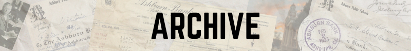
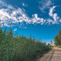
2024 Calhoun Produce Corn Maze Drone
Every year, Calhoun Produce puts on a fall "Fun on the Farm" which includes an incredible Corn Maze. This year, they celebrated 150 years of State of Georgia Agriculture!
Location: 5075 Hawpond Rd, Ashburn, GA
Location: 5075 Hawpond Rd, Ashburn, GA
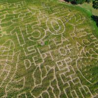
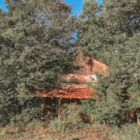
Abandoned Farm House
If you zoom in on this old farm house, you can see the tree growing out of it.
Nesmith Road in Ashburn, Georgia
Nesmith Road in Ashburn, Georgia
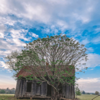
Beaver Dam
Shepherd Rd., Coverdale
Bee Boxes
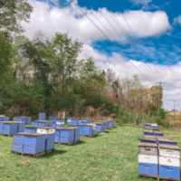
located off of Mattie Avenue in Sycamore, GA
Coordinates: 31°40'49.1"N 83°38'37.5"W
Coordinates: 31°40'49.1"N 83°38'37.5"W
Bell Rd. Home

Location: Bell Rd. In Sycamore, GA
Birds Migrating

Location: Bussey Rd. and Rockhouse Rd.
Clyatt Rd. Sunset

Location: Clyatt Rd. In Sycamore, GA

Cofer Rd. Sunset

Location: Cofer Rd in Sycamore, GA
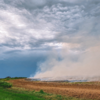
Controlled Burn
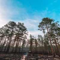
Rebecca-Waterloo Rd.
Sycamore, GA
Sycamore, GA
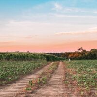
Cotton Field with Running Pivot
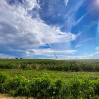
Julianne Rd.
Coverdale
Location: Forshee Rd. in Coverdale, GA
Cravey Morning Fog

Location: Cravey Rd in Sycamore, GA
Deer Tracks in a Peanut Field
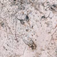
Location: Murray Rd., Ashburn, GA
Dirt Road Goldenrod
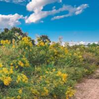
Location: Rachel’s Rd. In Sycamore, GA
Dusk on Nelson Rd.

Nelson Rd., Ashburn, GA
Dusky Corn Field
Location: Rusty Nail Rd in Ashburn, GA
FAA traffic control
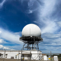
Oak Grove Rd.
Coordinates: 31°41'45" N 83°45'3" W
Coordinates: 31°41'45" N 83°45'3" W
Field Corn
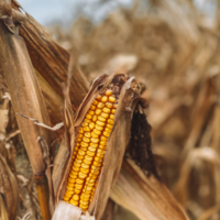
Alberson Road in Ashburn, Ga
Field Road

on Ireland Road in Ashburn, Ga
Field road and peanut field
On McKenzie Road in Ashburn, Ga
Grain bins on Cofer Rd.

2321 Cofer Rd.
Ashburn, GA
Ashburn, GA
Grit and Age

Location: Denham Road & Honeysuckle Road in Sycamore, GA 31714
Hobbs Store
located in Dakota, Georgia on Hwy 41 N.
Coordinates: 31°46'33" N 83°41'36" W
Coordinates: 31°46'33" N 83°41'36" W
Hobby School Rd. Sunset

Location: Hobby School Rd in Ashburn, GA

Honeysuckle Sunset

Location: Honeysuckle Road in Sycamore, GA 31714
Ireland Road Occupants

Location: Ireland Rd., Ashburn, Georgia