
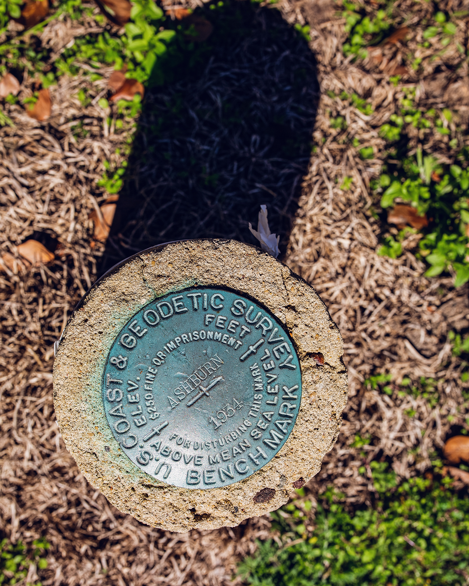
Geodetic Survey Bench Mark from 1934
Dublin Core
Title
Geodetic Survey Bench Mark from 1934
Description
Have you ever seen this marker? This is a US. Coast & Geodetic Survey Bench Mark from 1934. This is just 1 of 17 (!!) located in Turner County. There is a 44-page doc you can read ALL about this!
These reference points are developed and maintained by NOAA’s National Geodetic Survey (NGS). These permanent marks are called “survey marks” (you may hear survey marks called “benchmarks,” but benchmarks are only one type of survey mark).
Often, survey marks are marked with a metal disk. If you want to try to find them, you can search this interactive map for the locations of all 17! View here
Location: Corner of E. College Avenue & McLendon St. in Ashburn, GA
Creator
Sami Mastrario
Date
February 20, 2021
Collection
Citation
Sami Mastrario, “Geodetic Survey Bench Mark from 1934,” Turner County Project Digital Archive Repository, accessed July 24, 2026, https://turnercountyproject.com/archive/items/show/800.
Social Bookmarking
Embed
Copy the code below into your web page
Comments